


Great Springs Project – Strategic Conservation Prioritization
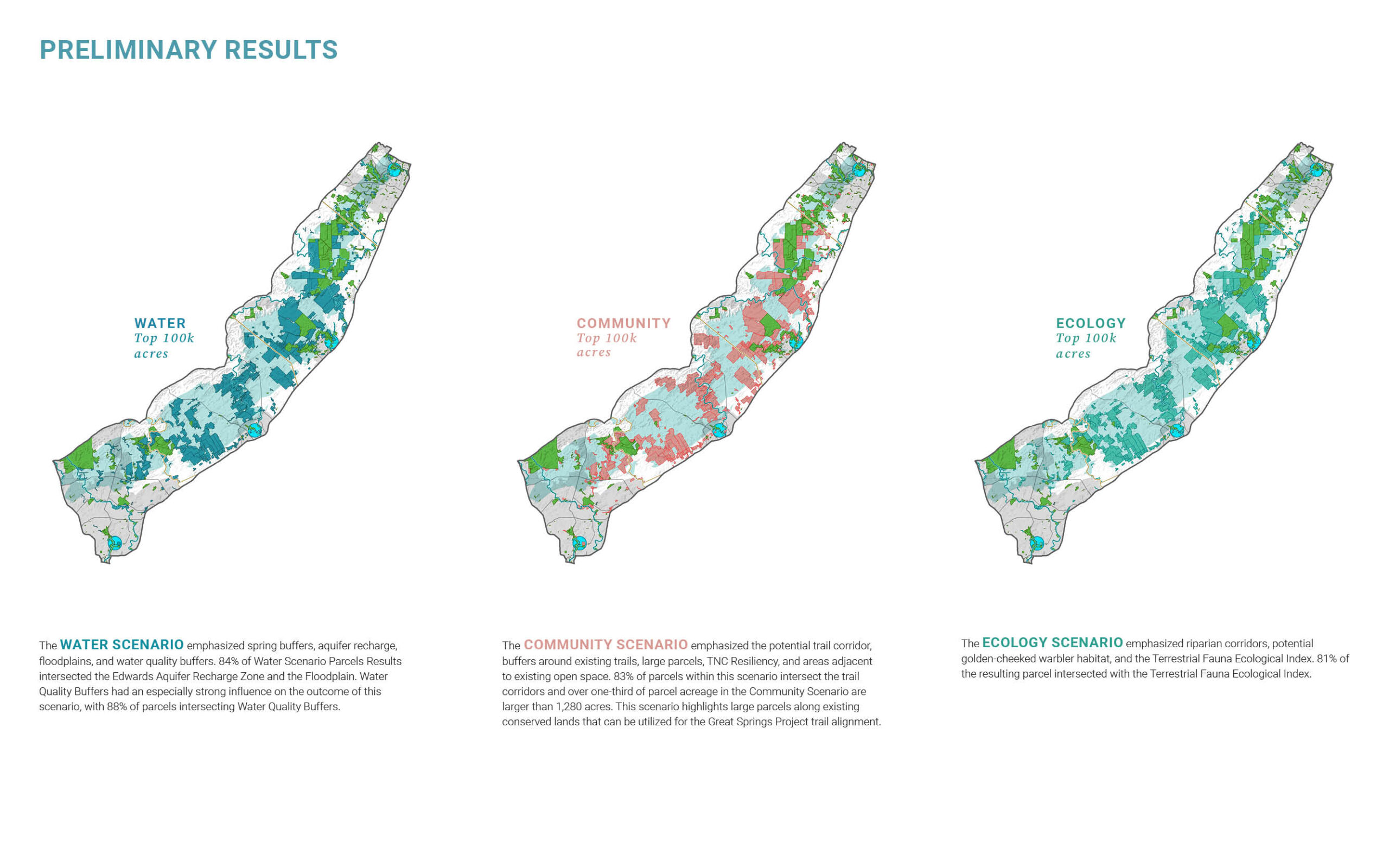
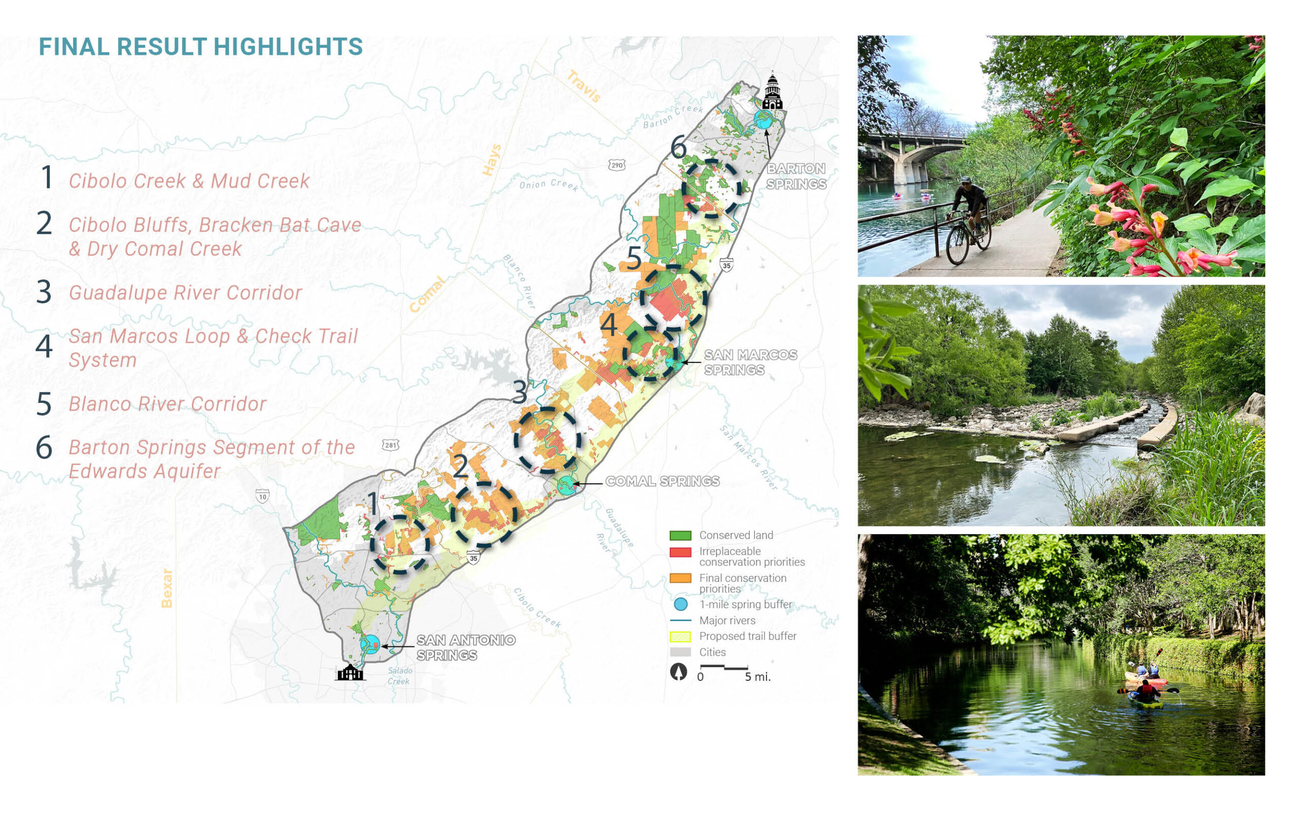
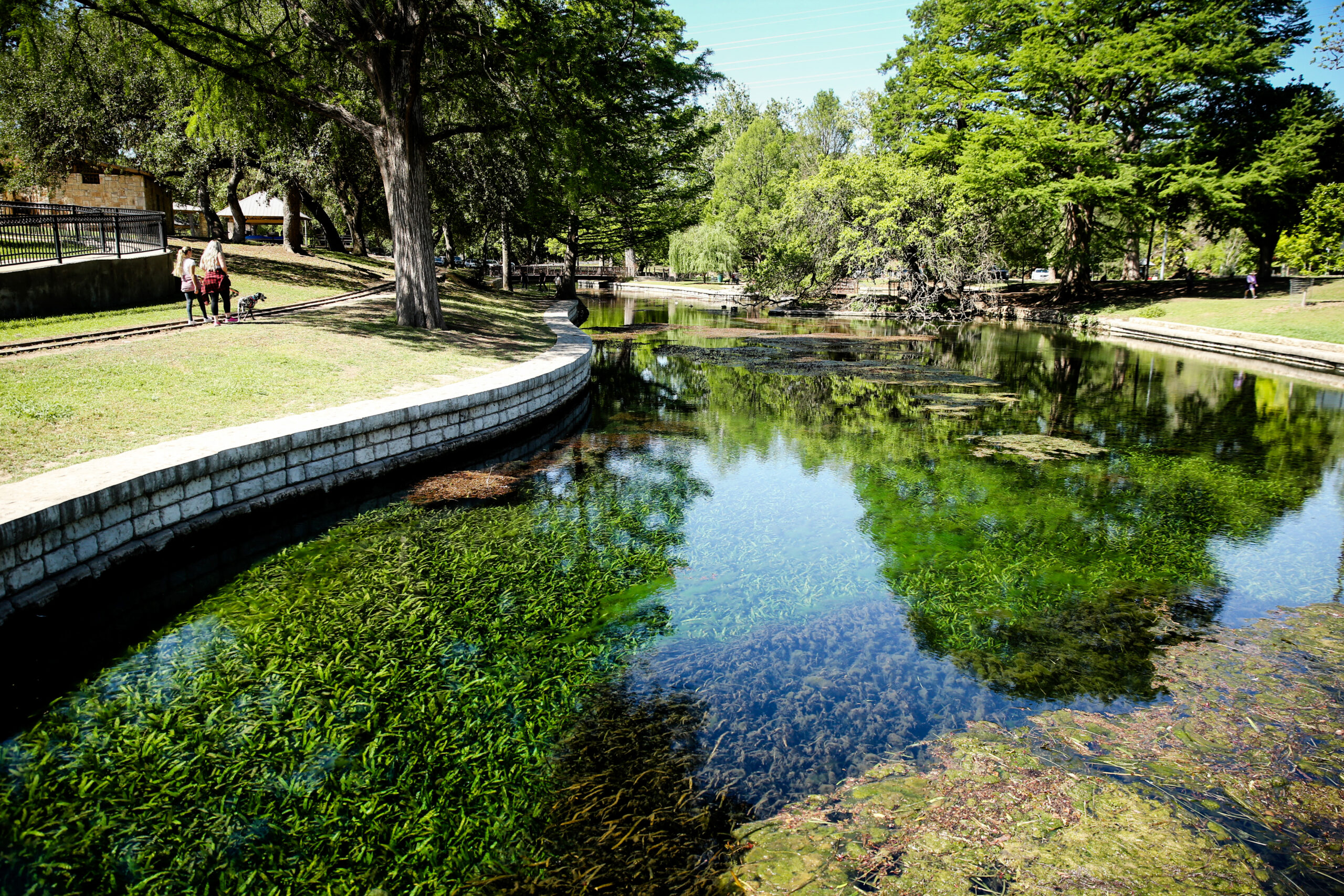
The Strategic Conservation Plan supports Great Springs Project’s (GSP) mission and actions through the determination of conservation priorities within a potential trail corridor spanning from Austin to San Antonio. The trail is proposed to span from the Texas Capitol to the Alamo and connect to significant springs along the way, including Barton Springs, San Marcos Springs, Comal Springs, and San Antonio Springs. Siglo Group used GIS to determine conservation priorities along the corridor associated with water, ecological, and cultural resources.
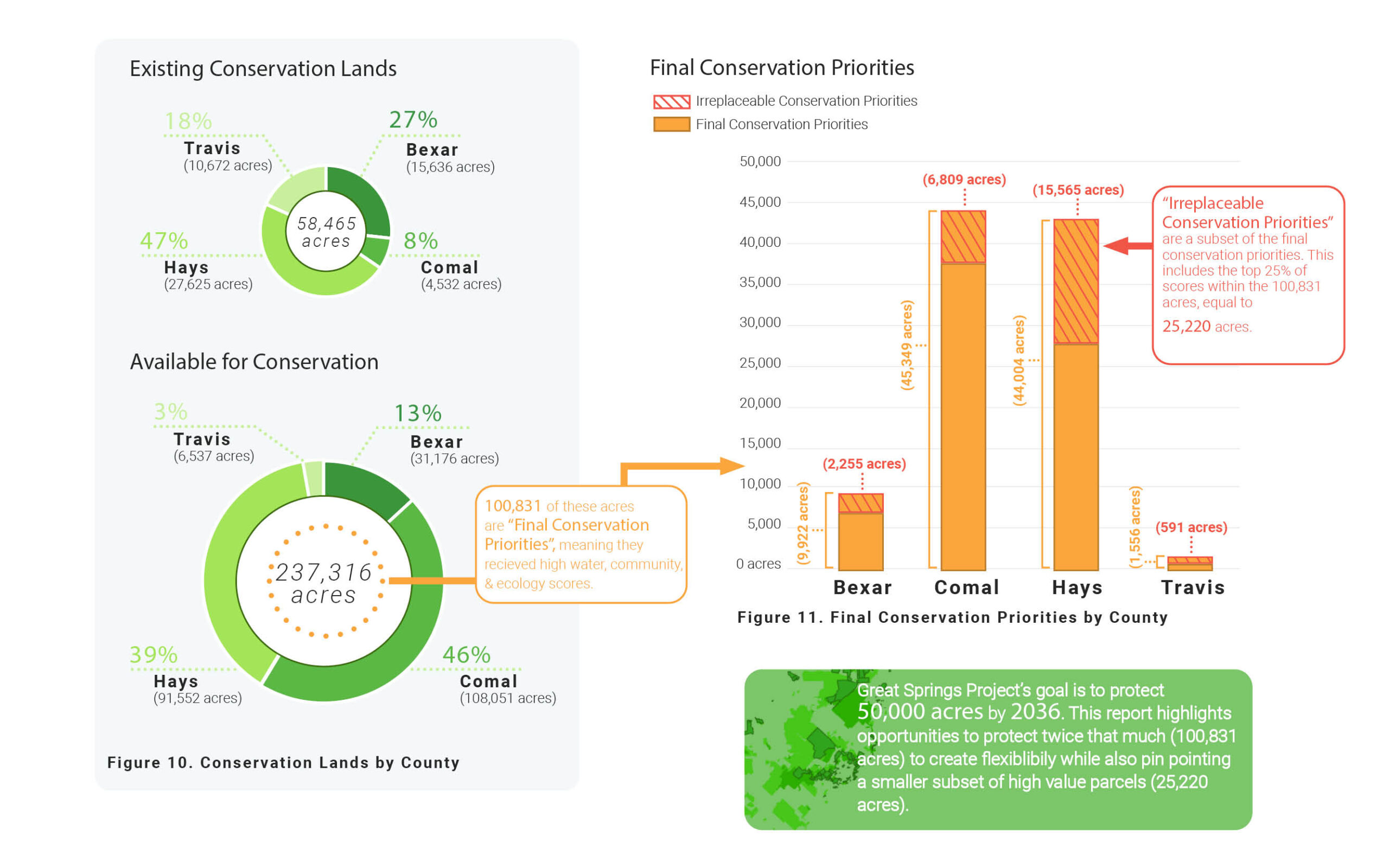
This work helps guide the implementation of trail and conservation projects that optimize the use of GSP resources in creating a world-class trail amenity, while at the same time identifying and protecting over 50,000 additional acres in the recharge and contributing zones of the Edwards Aquifer in Travis, Hays, Comal, and Bexar Counties. The products generated through this project allows GSP staff, experts, and stakeholders to evaluate corridors and particular parcels for fee simple, conservation easement, and/or trail easement acquisition.